How many countries does Germany border with? How are Bremen, Hamburg and Berlin different from other German cities? In which state is Germany’s oldest city located? You can find out the answers to these questions in this article!
Sixteen states make up Germany. Each of them has its own character and a unique history, because until the middle of the nineteenth century there were many small states on the territory of modern Germany, constantly changing its borders. Even the dialects spoken by people in different parts of Germany are very different.
Neighbouring countries (France, Poland, the Czech Republic, Denmark and others) have at one time had a major impact on the German borderlands. The German states have their own laws. We will try to get at least a rough idea of the uniqueness of each of the states.
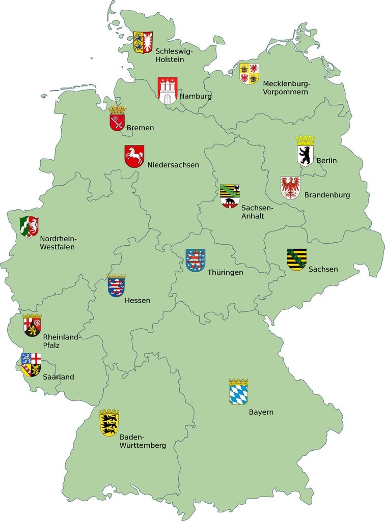
Sixteen modern German states were formed after the Second World War.
The old German states that came into being in Germany include Baden-Württemberg, Bavaria, Bremen, Hamburg, Hesse, Lower Saxony, North Rhine-Westphalia, Rhineland-Palatinate, Saarland and Schleswig-Holstein (these states have existed since 1952, Saarland since 1957). Berlin had a special status after the war.
The GDR was also originally divided into states (Brandenburg, Mecklenburg-Vorpommern, Saxony, Saxony-Anhalt, Thuringia), but in 1952 the states were replaced by fourteen districts, and it was not until 1990 that the division into states resumed in the GDR. After German unification in 1990, these lands were merged with the Länder of the FRG (now known as the new ones) to make a total of sixteen (Berlin was also granted being Länder).
The German federal state (Bundesland) is now considered a member state of the federation (Gliedstaat). That is what it is called in the main state documents.
What is important is that it is not Germany that is divided into states, but the federal states that come together to form the state of Germany.
Let us walk across the map of Germany from north to south
To the north, there are three coastal states: in the west Lower Saxony faces the North Sea, in the east Mecklenburg-Vorpommern is washed by the Baltic Sea and in the middle of Schleswig-Holstein has access to two seas – the North Sea and the Baltic. In Germany they have to go to their sea to the north.
In Mecklenburg-Vorpommern, the coastline and beaches stretch for 350 kilometres. Look at the map – to the east is Poland, these lands were once Slavic lands. Mecklenburg-Western Pomerania is also visited for its lakes – there are about two thousand of them!
Why is Pomerania called Vorpommern? Because the other part of this ancient land is now in Poland.

As we can see (or rather hear), some of the German lands have double names. It is an indication that they were formed by uniting a number of previously independent areas. In Schleswig-Holstein, for example, part of Schleswig was at one time a Danish territory (Denmark now shares a border with the German state).
Among the German states, three are cities. They are Bremen, Hamburg and Berlin.
It would be more correct to say that the state of Bremen consists of Bremen and Bremerhaven. In between there is 65 km of the land of Lower Saxony. After the Second World War, the American occupation zone in Germany was vast, but it had no access to the sea. The British gave them two cities, Bremen and Bremerhaven, standing on the Weser River. Bremerhaven has a huge sea harbour on the North Sea. And Germany’s largest port is Hamburg on the River Elbe (the Elbe also flows into the North Sea).
A special land city in Germany is Berlin, once divided by the Wall (remnants of which still stand in the streets for memory). Berlin, like any capital city, is a lively and cosmopolitan city. Berlin is also the best city for freelancers.
Berlin is located in the middle of Brandenburg. These areas were once Slavic areas. The Brandenburg Mark (Brandenburgian Brand stands for land on the border) was founded in 1157. Now Brandenburg borders Poland, and the words Mark Brandenburg are still in use – you can see them on butter labels, for example.
If we move further south on the map, just south of the above-mentioned lands, we see three Saxon states at once – Lower Saxony, Saxony-Anhalt and Saxony proper. These three lands stretch diagonally across Germany.
The Saxons were an ancient Germanic tribe. With them about thirty years persistently fought Charlemagne, in 802 finally having attached Saxony to the Frankish state (from the Frankish state arose modern France, Germany and Italy). Saxony was later divided into parts, and there are now three states with that name in Germany. All three Saxon states are on the Elbe.
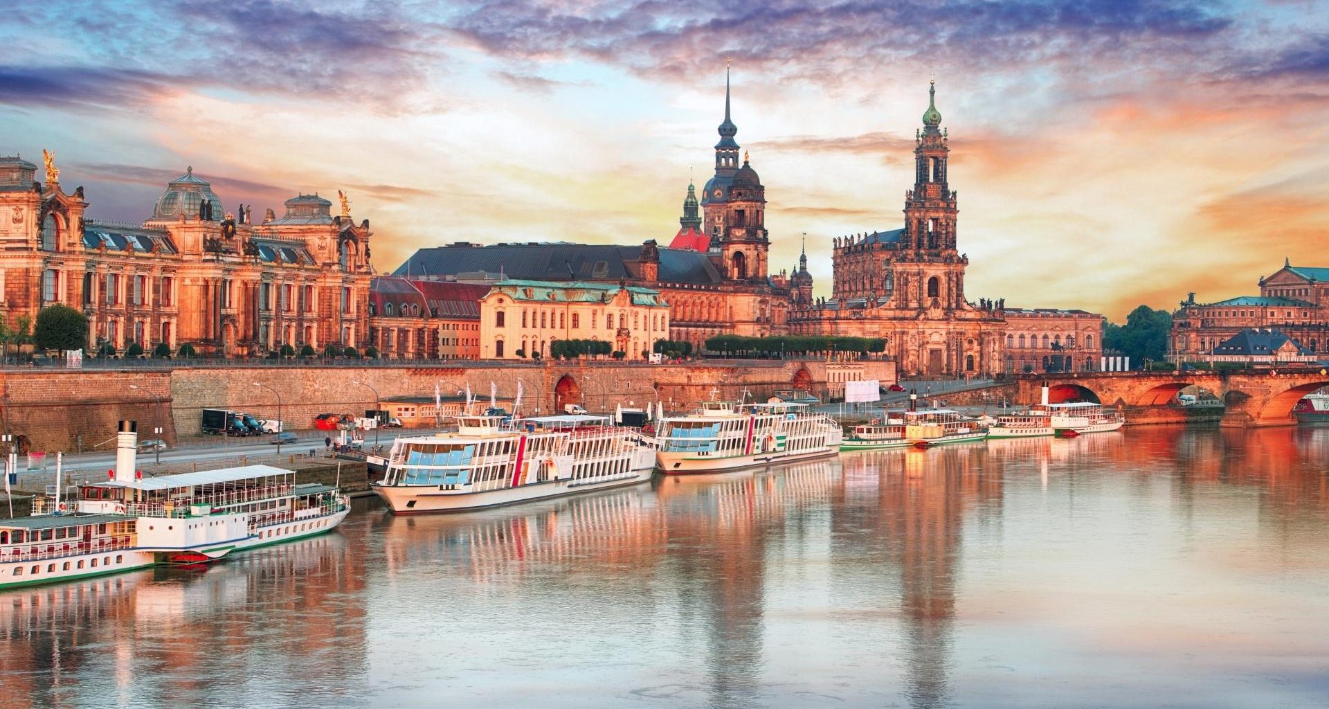
Lower Saxony (Niedersachsen) lies in the lower reaches of the three rivers, the Ems, the Weser and the Elbe (i.e. these rivers reach the sea here), hence the name. Sachsen-Anhalt was the centre of Germany in the Middle Ages and has a large number of castles and fortresses. Saxony (Freistaat Sachsen) is home to Dresden and the extraordinary-looking mountains, here called the Saxon Switzerland.
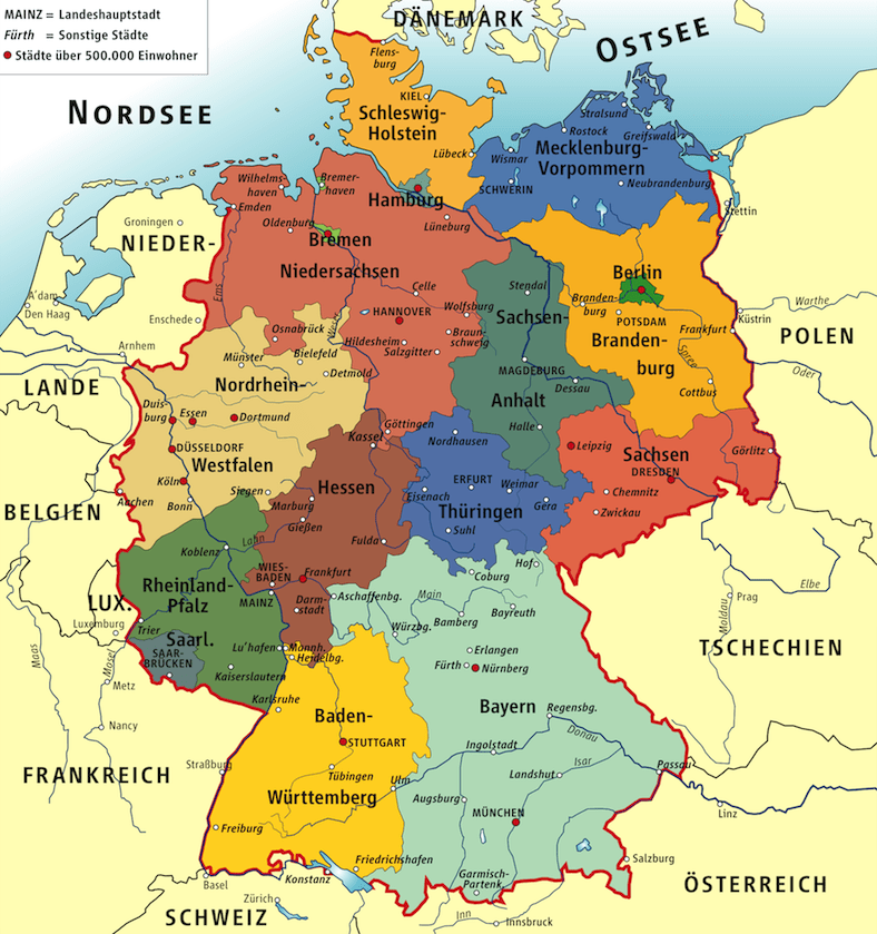
If we descend a little further down the map, we can see the Rhine in the west of Germany, and on it stand the three German states of North Rhine-Westphalia, Rhineland-Palatinate and Baden-Würtenberg (here the Rhine runs along the border). The Rhine is the river on which the Germanic tribe of the Franks, who founded the once mighty Frankish state, originally lived.
In North Rhine-Westphalia (Nordrhein-Westfalen) two surprisingly different territories came together. While the Westphalians are often seen as slow, humourless, and punctual, the North Rhinelanders are typically easy-going, gregarious, and fun-loving. The British joined the two territories after the war. It was important for them to get the Ruhr area, which lay in the middle of two areas – coal was extracted there and steel was processed (by the time almost all mines were closed and other branches of industry were developed).
Rheinland-Pfalz is home to Trier, Germany’s oldest city. The capital of Mainz is also an ancient city, founded by the Romans. It is no coincidence that the coat of arms of the Rhineland-Palatinate has grape leaves on it – the Romans grew grapes and made wine on the banks of the Rhine and Moselle. Even today, two thirds of all German wine is made here.
Baden-Württemberg is in the far south. Here lies the Swabian Alb mountain range. As it is made up of soft limestone, it has many caves, dungeons, and underwater lakes. Remains of cave bears and other Stone Age predators, as well as those of ancient humans, have been found in the caves. Baden-Württemberg is also home to Germany’s largest lake, Lake Bodensee. Baden-Württemberg has a thriving engineering industry, and for good reason: It was here that Gottlieb Daimler and Karl Benz patented the first gasoline-powered car.
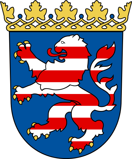
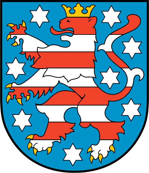
In the middle of the map we are left with two lands – Hesse and Thuringia. It is no accident that we have taken them together. Their coats of arms are very similar: two lions in red and white stripes.
Hesse was once part of Thuringia. An old guidebook about 150 years ago called Thuringia (Thüringen) the “green heart of Germany”. There are probably far fewer forests here now, but there is a very unusual one – an ancient beech forest. You can walk there only on a path through the trees.
Hessen is a very contrasting land. On the one hand a large industrial centre with the skyscrapers of Frankfurt, on the other hand the densely populated cities are surrounded by large areas of forests. In Hesse, we encounter many reminders of the Romans – the Limes once straddled the border here, and parts of towers and even fortresses remain.
At the edge of the Rhineland-Palatinate lies the Saarland. Quite small, it is nevertheless singled out. Over the last two hundred years it has changed its citizenship eight times. Sometimes French, sometimes German and sometimes independent. To this day local children are still actively learning French in schools. In 1957, it became the last of the “old” (i.e. part of the FRG) German lands.
Two mountainous states remained in the south. One, Baden-Württemberg, we have already mentioned in connection with the Rhine. The other is Bavaria, once conquered also by Charlemagne. To the south of these two lands lie the mountains.
Bavaria (Freistaat Bayern) is the largest of the federal states. It occupies a fifth of Germany. Bavaria has the highest mountain in Germany, the Zugspitze (2962 m). Bavaria attracts winter sports, and in the autumn there’s the spectacular Oktoberfest in Munich. The first German sausages were made in Bavaria, in the town of Regensburg: about 850 years ago, when they built a stone bridge across the Danube, for the builders were organized sort of a dining room, where just fried these sausages. They are now one of Germany’s symbols.
And so our review has come to an end. We hope that it has helped to systematise your knowledge of the German states.
Do you want to get your German language learning planner?
Dive into a World of German Mastery with Leo. Over 7500 enthusiasts are already unlocking the secrets to fluency with our tailored strategies, tips, and now, the German language learning planner. Secure yours today and transform your language journey with me!


